|
|
Post by dboyseeker on Dec 30, 2009 0:46:03 GMT 10
Taken from the Landsat 7 satellite. Since its launch 10 years ago, in 1999, the Landsat 7 satellite has been orbiting the Earth under the command of NASA and the USGS, compiling incredible images of our planet as seen from space. Von Karman Vortices  As air flows over and around objects in its path, spiraling eddies, known as Von Karman vortices, may form. The vortices in this image were created when prevailing winds sweeping east across the northern Pacific Ocean encountered Alaska’s Aleutian Islands. Bogda Mountains  The Turpan Depression, nestled at the foot of China’s Bogda Mountains, is a strange mix of salt lakes and sand dunes, and is one of the few places in the world that lies below sea level. Many more pics on site >> www.huffingtonpost.com/2009/12/28/landsat-7s-stunning-satel_n_402164.html?slidenumber=skyrswDNvbc%3D&slideshow&slideshow&slideshow&slideshow#slide_image |
|
|
|
Post by brillbilly on Dec 30, 2009 0:57:05 GMT 10
 lol anybody for latte coffee.nice pics dboy ;D |
|
|
|
Post by brillbilly on Dec 30, 2009 1:02:30 GMT 10
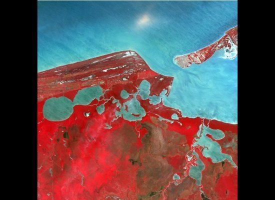
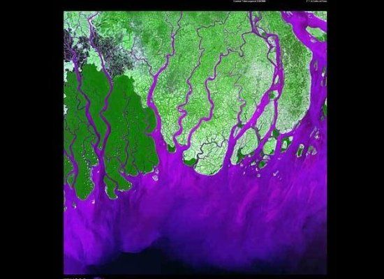
 May 2nd, 2002. Description: Named after the ancient Mayan Province of Kimpech, the state of Campeche comprises much of the western half of Mexico’s Yucatan Peninsula. Rivers in southern Campeche drain into the immense Terminos Lagoon, the entrance to which is protected by a long barrier island, Isla Del Carmen.  February 1st, 2000. Description: The Ganges River forms an extensive delta where it empties into the Bay of Bengal. The delta is largely covered with a swamp forest known as the Sunderbans, which is home to the Royal Bengal Tiger. |
|